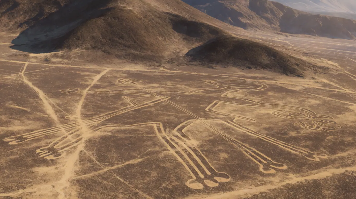
AI illustration of Nazca Lines figure (plan view) for reference only.
AI ILLUSTRATION FOR REFERENCE ONLY

Nazca Lines

Nasca Lines · Lines and Geoglyphs of Nasca and Palpa · Nazca geoglyphs
MUSEUM OBJECT

Mainstream consensus: The geoglyphs are extensively surveyed cultural landscapes produced by Nazca and related communities using desert pavement techniques. UNESCO protects the Nasca and Palpa lines as heritage. Ancient-astronaut runway readings are modern overlays rejected by archaeological inventories of zoomorphs and ritual context.

Share this page
Short answer

The Nazca Lines are vast desert geoglyphs in Peru's Ica Region - hummingbirds, spiders, monkeys, trapezoids, and kilometer-scale straight lines made by clearing dark pavement stones to expose lighter soil. Created by Nazca culture centuries ago, they are UNESCO-listed ritual landscapes, not alien runways.

From a small plane over Peru's dry pampa, a hummingbird suddenly resolves as a single drawing larger than a city block. The Nazca Lines are geoglyphs - pale trenches cut into dark desert pavement - spread across the Nasca and Palpa landscape and protected today as UNESCO World Heritage for their cultural scale and fragility.

Desert pavement as a drawing tool

Makers cleared iron-stained surface stones to uncover lighter soil, a technique that lasts for centuries in hyper-arid air. Trapezoids and straight lines share the plateau with spiders, monkeys, and birds. The work is shallow, not monumental masonry, which is why a single truck track can scar a figure that survived a millennium of wind. Scale impresses; the toolkit remains human - rope, sighting stakes, and patient clearing across the pampa.

Flight, Reiche, and UNESCO

Peruvian aviation in the 1920s-1940s made systematic recording possible; Maria Reiche's decades of measurement turned stewardship into a public vocation. UNESCO's 1994 inscription locked international attention onto conservation rules, observation platforms, and controlled overflights. Drone and satellite surveys still expand the known corpus while reminding managers how fragile the desert skin remains under tourism pressure.

Runway myths versus ritual readings

Ancient-astronaut authors loved long trapezoids as landing strips. Archaeologists answer with zoomorph inventories, processional hypotheses, and water-related ritual debates that stay inside human culture. Ground-level layout methods do not require aircraft. Wonder at the scale; keep the spacecraft in fiction unless someone finds a hangar under the pampa - something surveys have not delivered.

In popular culture

Travel posters, documentary aerials, and meme overlays recycle the spider and hummingbird endlessly. Soft adventure tourism sells the mystery while boardwalks try to keep sneakers off the art. Neighbor megalith and artifact pages reward the same discipline - start with UNESCO language before the alien caption.

New drone and satellite surveys keep adding figures without overturning the human-made consensus. Each fresh outline still sits in the same desert pavement technique - dark stones cleared to show pale soil. That continuity matters more than any single viral runway caption. Conservation rules exist because a truck track can erase what centuries of wind left alone.

Sightings and object accounts

Attributed sightings, recoveries, and object histories from named sources. Links open the originals; AnomalyWiki does not verify these claims.

Claims vs mainstream

The claim

Lines are too big for humans without aircraft.

Mainstream view

Survey and construction experiments show feasible ground-level layout methods.

The claim

All figures are runways.

Mainstream view

Zoomorphic and ritual forms dominate; runway claim is a modern overlay.

The claim

They are perfectly invisible from the ground.

Mainstream view

Many forms can be recognized from nearby hills.

The claim

New satellite finds prove aliens returned.

Mainstream view

Drone and satellite surveys expand the known corpus of human-made geoglyphs; protection rules tighten because vehicles still damage the desert skin.

Timeline

  1. c. 200 BCE-700 CENazca culture creates and maintains desert geoglyphs.Source: UNESCO; archaeological chronologies
  2. 1920s-1940sAerial photography brings systematic recording; Maria Reiche later becomes key steward and popularizer.Source: Maria Reiche research histories / UNESCO context
  3. 1994Lines inscribed as UNESCO World Heritage.Source: UNESCO listing 700
  4. 2000s-2020sNew geoglyph discoveries via satellite and drone surveys expand the known corpus while protection rules tighten against vehicle damage.Source: Heritage reporting summaries

FAQ

Who made the Nazca Lines?

Archaeological chronologies tie the main corpus to Nazca culture in the centuries around 200 BCE to 700 CE, with related work in the wider Nasca-Palpa landscape.

Are they alien landing strips?

No. Inventories are dominated by animals, plants, and geometric forms tied to ritual and procession research - not spacecraft infrastructure.

How were the lines made?

Makers removed dark desert pavement stones to expose lighter subsoil, creating lasting pale trenches in the arid climate.

Can you see them only from the air?

Aerial views reveal whole figures best, but many lines and forms are recognizable from nearby hills and observation towers.

Why does UNESCO protect the site?

The 1994 World Heritage listing recognizes an outstanding cultural landscape of geoglyphs and the need to limit vehicle damage.

Did Maria Reiche invent the lines?

No. She measured, mapped, and advocated for protection, becoming the public face of stewardship after pilots and archaeologists had already recorded them.