Location and access
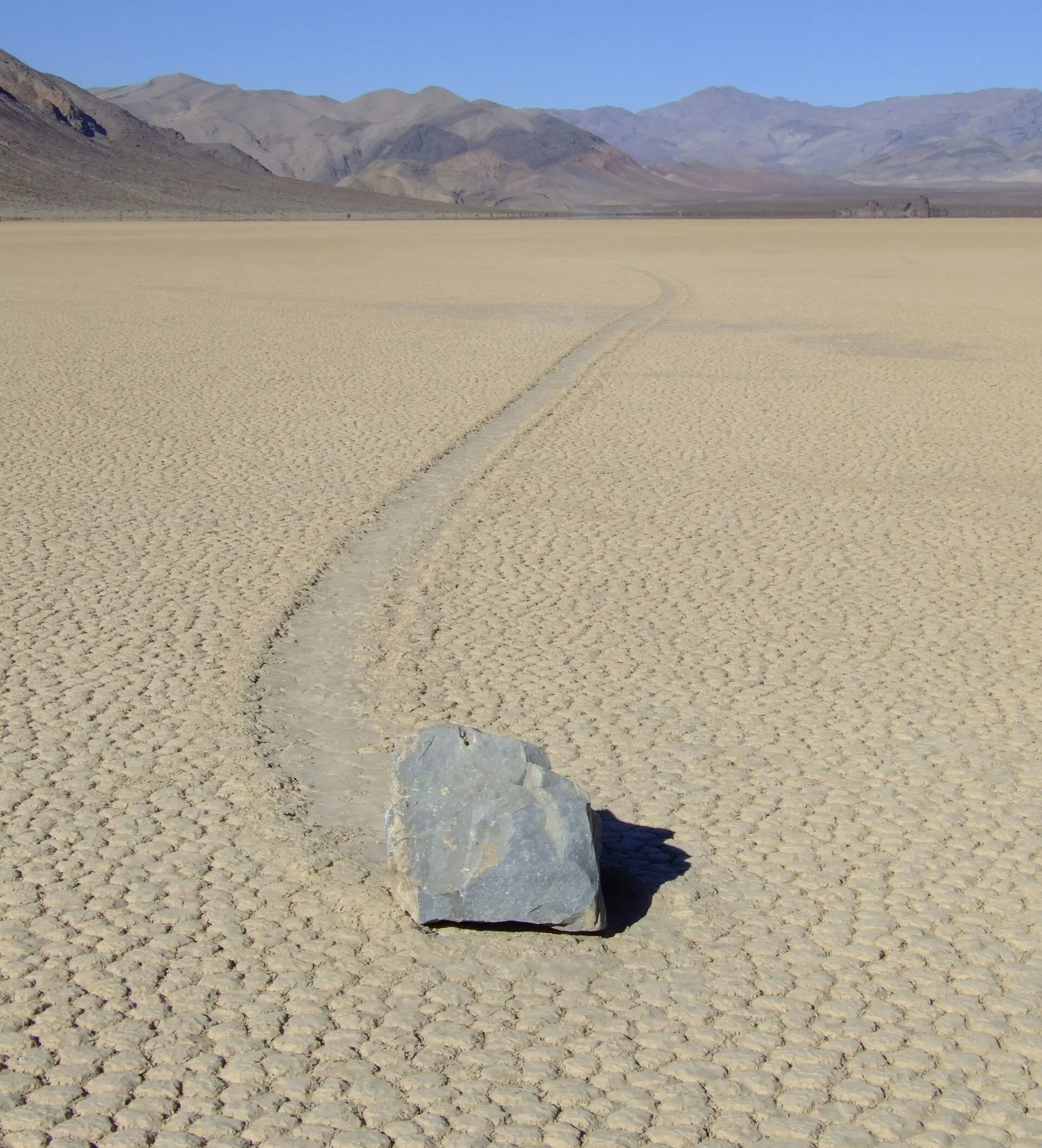
Racetrack Playa sits in a remote valley of Death Valley National Park, wedged between the Cottonwood and Last Chance mountain ranges in eastern California. Reaching it means driving a rough, washboarded dirt road that branches off near Ubehebe Crater and runs roughly 27 miles south past Teakettle Junction to a pair of parking areas at the playa's northern end.
The National Park Service recommends a high-clearance, four-wheel-drive vehicle with heavy-duty tires; standard rental cars frequently pick up flat tires on the gravel, and there is no cell coverage anywhere nearby. Visitors can walk out to see the stone trails, but driving onto the playa itself, moving any rock, or walking on wet mud are all off-limits, since tire tracks and footprints can scar the fragile surface for years.
History and legend
Prospector Joseph Crook gets credit for the earliest personal account, in 1915, after his wife marked a stone's position and found it had shifted days later. It took until 1948 for the furrows to reach scientific print, when USGS geologists Jim McAllister and Allen Agnew, mapping the Racetrack's bedrock, guessed at strong wind gusts and dust devils.
Through the 1950s to 1970s, geologists argued over rival ideas. George Stanley proposed that thick sheets of ice floated rocks just clear of the mud, while Caltech's Robert Sharp staked and named individual stones, including a 320-kilogram boulder he called Karen, to test that claim. Some staked rocks moved past their enclosures while neighbors stayed put, which did not fit one rigid sheet moving everything together. Popular explanations wandered further still, with visitors floating magnetism, extraterrestrial interference, or plain magic, since nobody had ever caught a rock mid-slide. That changed only in the winter of 2013 to 2014, when a dedicated weather station and GPS-tagged stones finally caught the real event on camera.
Related places and beings
Racetrack Playa belongs to a small family of landscapes where an ordinary physical process looks like sorcery until someone actually measures it. Turkmenistan's Darvaza gas crater and New York's Eternal Flame Falls both run on the same trick: a real fire, driven by chemistry that only gets fully pinned down after patient, instrumented fieldwork.
Mexico's Cave of the Crystals shares the pattern on a far slower timescale, with gypsum beams that puzzled visitors until crystallographers worked out the exact, narrow water temperature needed to grow them undisturbed for centuries. Readers drawn to crop circles will recognize a similar arc here: a strange trace left on the ground, years of competing folklore, and eventually a research team that shows up with the right instruments in the right season.
In popular culture
The sailing stones circulated for decades as a staple "unsolved mystery" in general-science writing and Death Valley travel guides, long before anyone filmed one actually moving. When the 2014 PLOS ONE study finally caught the mechanism on GPS and camera, outlets around the world covered it as a rare case of a famous unexplained phenomenon getting solved outright rather than deepened.
The playa remains a bucket-list stop for Death Valley road-trippers precisely because the rocks and their trails are real, visible, and strange to look at, even though the ice-shove events that actually move them are vanishingly rare. Nature documentaries and photographers still frame the site as otherworldly, typically pairing the eerie images with the correct physical explanation rather than leaving the mystery open.


